Quickstart

_images/husky_missi.gif

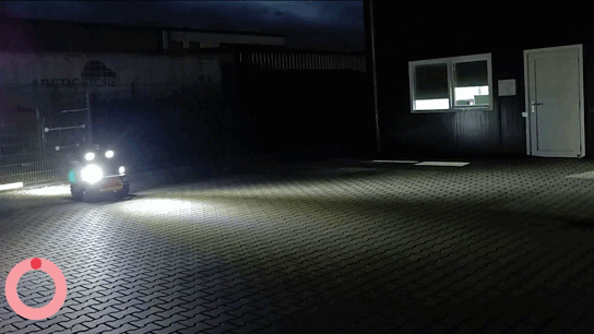
The video illustrates GPS waypoint navigation. The footage is sped up by x4. The red timer illustrates the waypoint collection and the gps points illustrate the recording of the GPS points. The green timer illustrates the execution of autonomous navigation based on GPS. The current configuration has the Husky go within 0.5 meters of the goal before going to the next goal due to cloudy weather. TEB local planner has been used.
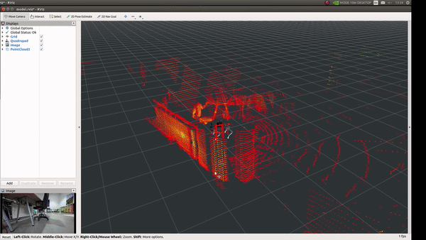
Indoor & Outdoor Navigation

  • Launch the gps navigation driver via:

roslaunch mbs_gps_navigation gps_navigation.launch

Important

This driver should always be running when performing waypoint navigation.

Indoor navigation

This will launch all the pre-configured settings of your navigation stack for odom.

  • Next launch the record odom waypoints via:

roslaunch mbs_waypoint_follower indoor_record_waypoints.launch
  • On launch, instructions will be displayed on the shell on the usage of initiating and storing the odom coordinates.

  • Once you have saved your coordinates, you may launch the execution protocol via:

roslaunch mbs_waypoint_follower indoor_follow_waypoints.launch

Outdoor navigation

This will launch all the pre-configured settings of your navigation stack for gps.

  • Next launch the record odom waypoints via:

roslaunch mbs_waypoint_follower outdoor_record_waypoints.launch
  • On launch, instructions will be displayed on the shell on the usage of initiating and storing the GPS coordinates.

  • Once you have saved your coordinates, you may launch the execution protocol via:

roslaunch mbs_waypoint_follower outdoor_follow_waypoints.launch

Controller Alternative for GPS Recording

  • You may provide a list of GPS coordinates directly via gps_waypoints.yaml file located in the waypoints folder in the mbs_waypoint_follower package.

    • In it orientation represents the the quaternions of the final goal position and the position represents the latitude, longtitude, and altitude resepectively.

3D-SLAM

_images/a1_point_cloud.gif
  • Launch the indoor slam package via:

roslaunch mbs_slam indoor_slam.launch
  • Launch the outdoor slam package via:

roslaunch mbs_slam outdoor_slam.launch
  • Launch the localization slam package via:

roslaunch mbs_slam localization.launch

Saving the Point Clouds

rosservice call /hdl_graph_slam/dump
  • Save all the internal data (point clouds, floor coeffs, odoms, and pose graph) to a directory.

rosservice call /hdl_graph_slam/save_map "resolution: 0.05 destination: '/full_path_directory/map.pcd'"
  • Save the generated map as a PCD file.